Agricultural Extension System
The Department of Agricultural Extension(DOAE) had adopted the Training and Visit System (T&V) into implementtation in 1975 (B.E.2518) and then expanded the system to cover every province. The system was carried out efficiently and periodically adjusted for 4 time up to now, the latest was in 2008. Nowaday , the situations have changed repidly and have affected extension work inevitably.The most important thing is that extension tasks are numerous, varied, complicated, and need to integrate and collaborate with parties concerned. Consequently,the Department of agricultural Extension has designed the MRCF Agricultural Extension System in order to manage extension work at the field level efficiently under the changing situation at the present time and in the future.
MRCF System is the work process for extension officers to collaborate with farmers in a manner of learning and participation along with clear objectives according to potential, readiness and needs of farmers and community using M,R,C and F as tools
There are 4 main components in MRCF System as follows;
1.Mapping(M): It to study and analyze information for preparation to work, especially at field level-the emphasis is placed on map infomation wich indicates the direction of development.
2.Remote Sensing(R): It is to coordinate and provide services to farmers via distance communication and access to information.
3.Community Participation(C): It is to encourage participation and collaboration with farmers, communities and stakeholders by conducting various community/extensin platforms
4.Specific Field Sevice (F) or Focus: It is to specify target area/point that needs to be developed, and preparation to work at field level with specific/clear goal and purpose.
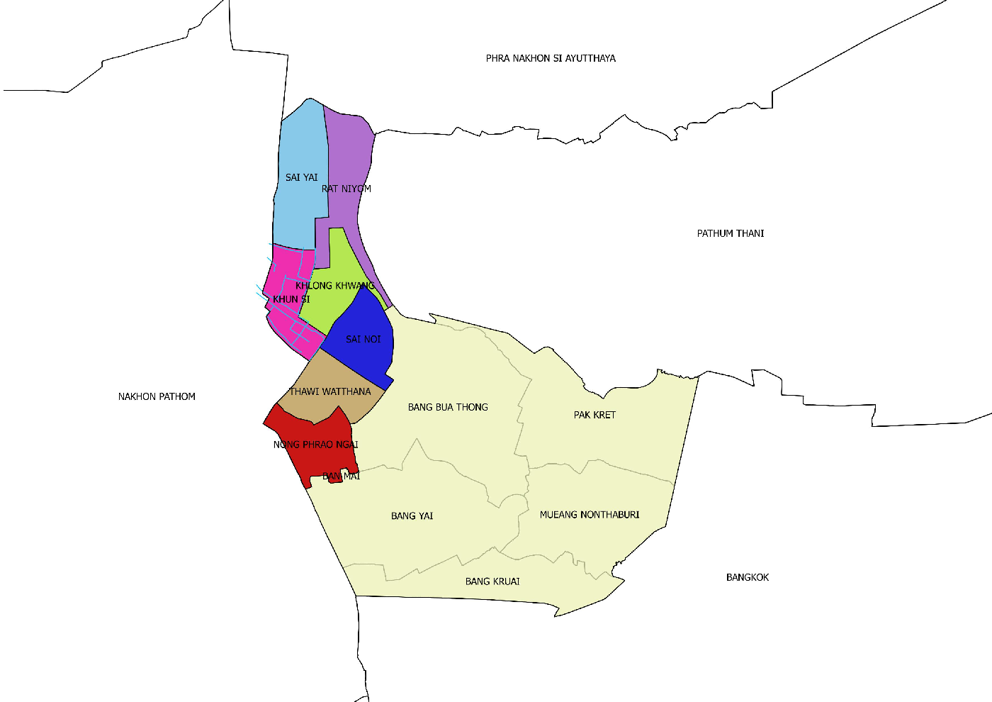
The district is subdivided into 7 subdistricts (tambon), which are further subdivided into 68 villages (muban). Sai Noi itself has subdistrict municipality status (thesaban tambon) which covers parts of tambon Sai Noi and Khlong Khwang. There are further 7 Tambon administrative organizations (TAO).
No. Name Villages
1. Sai Noi 11
2. Rat Niyom 8
3. Nong Phrao Ngai 12
5. Khun Si 8
6. Khlong Khwang 10
7. Thawi Watthana 8
Neighboring districts are (from the north clockwise) Lat Bua Luang (Ayutthaya Province) Lat Lum Kaeo (Pathum Thani Province), Bang Bua Thong, Bang Yai, and the districts Phutthamonthon and Bang Len of Nakhon Pathom Province.
Climate
The country occupies a territory of about 512.13 square kilometers.The climate is Southwest monsoon. Average annual rainfall is about 1,171 mm. and average temperature 28.20 degrees Celcius.
Land use
Agricultural areas: 83.12 % about 20,611 hectare. Community and buildings areas: 11.06 % about 2,743.50 hectare.Water resources: 3.41 % about 845.44 hectare.Other areas: 2.40 % about 595.04 hectare
Plant production
Farmer 4,037 households. Rice 11302 hectare,Vegetable 187.36 hectare fruit 171.20 hectare
Director of Sainoi Agricultural Extension Office.